
Saba's sea floor like never before
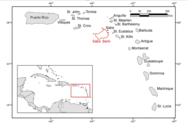
Dutch Caribbean Nature Alliance (DCNA)The Saba Bank is a submerged carbonate platform covering an area of around 2,200 square kilometers. Despite its size and ecological importance, there is still little known about its sea floor habitats. To combat this, a recent study (funded by the Ministry of Agriculture, Nature and Food Quality and conducted by Wageningen University and Research) used a collection of 2,144 georeferenced images from various surveys to piece together a digital image of Saba’s sea floor.
Findings
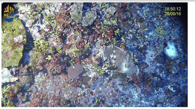
Applying machine learning techniques, researchers were able to develop models to map out ten distinct habitat types across the Saba Bank. This approach was groundbreaking, combining geographic coordinates with environmental factors like depth and topography to generate predictions with unprecedented accuracy. This technique represents a leap forward in local understanding of marine ecosystems.
The findings included a wide range of habitat types, each contributing to Saba Bank's unique ecological seascape. The new maps include coral reefs that fringe the southern and eastern edges, and expansive sand plains and macroalgae fields which dominate the central areas. Unexpectedly, the models also uncovered a rich coral community in the Luymes Bank's deeper waters, challenging previous ideas about coral distribution. These discoveries underscore the unpredictability of marine ecosystems and the importance of continuous exploration.
Next Steps
The journey doesn't end here. Despite the study's successes, areas like the Luymes Bank remain mostly unmapped. This study highlights the need for further field-based observations and highlights the dynamic nature of marine research. The implications of this study extend far beyond the Saba Bank, offering a blueprint for habitat conservation across the Dutch Caribbean. By providing detailed habitat maps, this research supports sustainable fishing practices, biodiversity conservation, and informed policymaking. For park managers, local governments, and conservationists, this wealth of information is invaluable, offering new insights into the ecological dynamics of marine environments.
Text: Dutch Caribbean Nature Alliance
Photos: Hans Leijnse; Hoetjes & Carpenter; Wageningen University and Research