
Using satellite imagery to map St. Eustatius coralita invasion
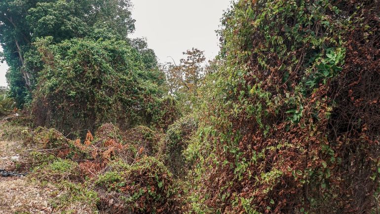
Dutch Caribbean Nature Alliance (DCNA), STENAPA, Technische Universität Braunschweig, University of Zurich, Utrecht University, Wageningen University & ResearchCoralita (Antigonon leptopus) is a fast-growing, climbing vine with beautiful pink or white flowers. Originally from Mexico, it started out as a popular garden plant, but has expanded its territory and is now aggressively invading natural areas. Its fast-growing nature means that it can outcompete most native species for terrain, quickly making it the dominant species, and reducing overall diversity. This is especially the case on St. Eustatius, where ground surveys indicate that the plant already appears on 15 to 33 percent of the island.
Mapping techniques
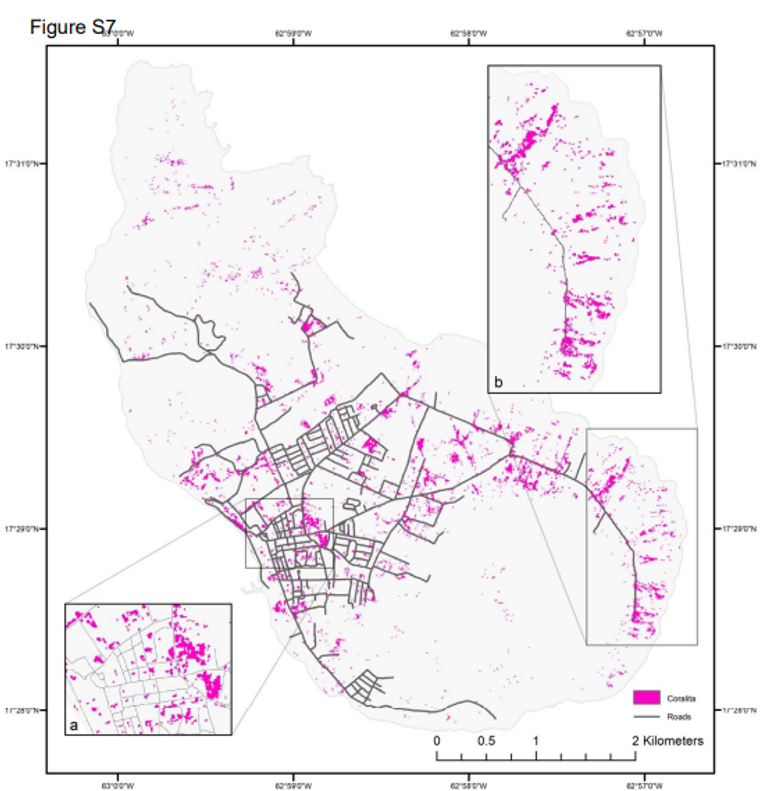
One of the biggest issues in controlling invasive species is accurately accounting for its presence, particularly if data needs to be collected over a wide area. This is where satellite imagery can help by providing an affordable, high spatial resolution option. A new collaborative study from the Utrecht University, University of Zurich, Wageningen University, and the Technical University of Braunschweig provided key insights by using such satellite imagery to identify Coralita. The method is successful, as areas dominated by Coralita emit a relatively distinct electromagnetic signal that can be detected by satellites. Once the distribution of Coralita has been mapped using this technique, it is possible to identify the environmental conditions associated with Coralita’s presence. This approach provides a relatively low-cost solution that is powerful, accurate and repeatable; key in identifying and monitoring its spread in future.
“In creating this map, it was my hope to produce something that could be useful for those who are caring for and protecting the incredibly special nature on Statia”, Elizabeth Haber, first author of this study.
Results
Using this method, researchers sampled 162 locations across St. Eustatius and estimated that Coralita was the dominant canopy cover (>50 percent) on over 3 percent of the island (64 ha). Perhaps more importantly, this map also showed that Coralita was not randomly distributed but generally found, for example in areas of water accumulation, near roads or near drainage channels. Furthermore, Coralita was often found in grasslands and areas of development and is relatively rare in natural forests, highlighting how human disturbances can promote the spread of Coralita. It is important to note that data filtering and physical limitations of using satellite imagery means that Coralita growing under trees or shrubs or in smaller patches is likely underrepresented in this study.
Conservation implications
Even with the physical limitations, the fact that this study is cost effective and repeatable means that consistent comparisons of Coralita’s distribution can be made over time. These comparisons are vital in understanding how populations and habitats are shifting, granting conservationists a fantastic tool in forecasting the spread of invasive species. Arguably the greatest asset of the Caribbean is its vast biodiversity. Already threats of climate change, habitat loss, invasive species and urban development are upsetting this fragile balance. St. Eustatius, although small, is home to several endemic plant species, two of which are the Statia morning glory and Statia milkweed, along with the critically endangered Lesser Antillean iguana which could all be threatened by the habitat alterations of Coralita growth.
More information
- To read more, please find the full report on the Dutch Caribbean Biodiversity Database.
Text: Dutch Caribbean Nature Alliance
Pictures: Achsah Mitchell
Map: Haber and colleagues, 2021